
Geography Studies and Open Datasets
Explore reproducible geographic analyses, data tables, charts and openly documented limitations. Download the associated study files and review the methodology before using results in research.
Open Research Datasets & Methods
These are reproducible analyses of our bundled data. They are not the competitor’s original studies and do not claim complete or current US geographic coverage. Every chart has downloadable observations and a method/limitation note.
County Reference Counts by State (Historical Sample)
How many county features appear in each state in our undated Basemap reference? These are not current official Census counts.
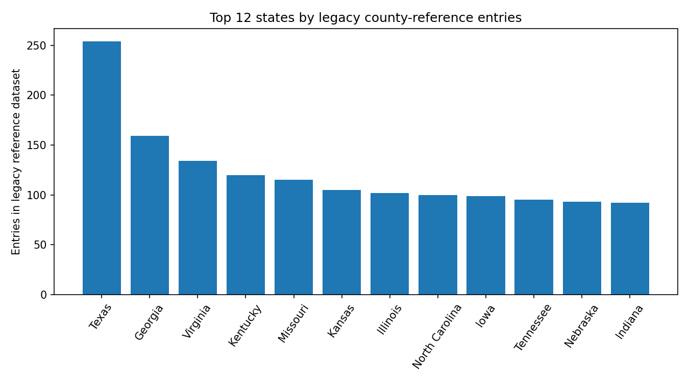
51 observations. Download observations (CSV)
Dataset caveat: Bundled legacy UScounties shapefile attributes: state names and GEOIDs; source vintage not independently verified. No claims about current Census county counts.
Where Our Curated City Centers Fall by Latitude
A histogram of 87 explicitly curated starter city points, not a random sample of all world cities.
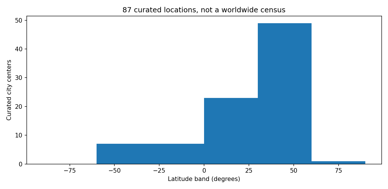
87 observations. Download observations (CSV)
Dataset caveat: 87 manually curated city reference centers in city-radius-starters-v10.json; nonrandom and not representative of the world.
Comparing Area Ratios in the Bundled Polygon Sample
An exploratory ranking of source-polygon area ratios, with unresolved geographic definitions clearly disclosed.

22 observations. Download observations (CSV)
Dataset caveat: Bundled approximate polygon areas from comparisons-23.json; states/countries and coastlines may have incomparable definitions.